


Catégories

Documents disponibles dans cette catégorie (178)
 Ajouter le résultat dans votre panier Affiner la recherche
Article
T. Mabhaudhi ; T.L. Dirwai ; C. Taguta ; A. Sikka ; J. Lautze |While there is a proliferation of Decision Support Tools (DSTs) to enhance agricultural water productivity (AWP) and related objectives such as food security, an assessment of their adoption and performance is not known to be undertaken. To deve[...]
Article
Agriculture plays a dual role in the conservation of European biodiversity, as extensive agricultural lands provide habitats for more than half of Europe's species, but intensification and abandonment of farmland threaten these species' habitats[...]
Article
The present study aims to support the Mapping and Assessment of Ecosystems and their Services (MAES) implementation in Greece, by synthesizing an indicator that could be used for abiotic attribute assessments and specifically for geodiversity. S[...]
Article
CONTEXT The Mediterranean basin and specifically Northeast Italy are recognised as climate change hotspots. The latter is a key socio-economic area in Europe among the most agriculturally productive. However, increasingly frequent drought period[...]
Article
The terroir effect refers to the interactions between the grapes and their natural surroundings and has been recognized as an important factor in wine quality. The identification and mapping of viticultural terroir have long been relying on expe[...]
Article
K. Mainali ; M. Evans ; D. Saavedra ; E. Mills ; B. Madsen ; S. Minnemeyer |Landscape scale wetland conservation requires accurate, up-to-date wetland maps. The most useful approaches to creating such maps are automated, spatially generalizable, temporally repeatable, and can be applied at large spatial scales. However,[...]
Article
C. Zagaria ; C.J.E. Schulp ; Z. Malek ; P.H. Verburg |CONTEXT The Mediterranean Basin has been identified as a climate change 'hotspot', a region where increased warming and drying are expected to occur at rates faster than the global average. Increasing scientific attention has therefore been draw[...]
Série
S. Abis, dir. ; A. Marie, coord. | Paris [France] : Club Déméter | Déméter : Economie et Stratégies Agricoles, ISSN 1166-2115 | 2023L’agriculture et l’alimentation sont au cœur des défis contemporains et des solutions de demain. Toujours déterminantes pour la sécurité collective et l’existence de chacune et chacun, elles conditionnent les trajectoires de développement durabl[...]
Ouvrage
L'agriculture est au coeur de la géopolitique. Combien de conflits s'enracinent dans une terre disputée ou dans une eau rare ? Combien de révoltes sont aussi celles de la faim ? Peut-on rêver de souveraineté ou de puissance sans sécurité aliment[...]
Article
The GIAHS-FAO program enhances the agricultural systems coevolved with humans through their dynamic conservation to guarantee the livelihood of future generations. The aim of this research was to assess, with a dynamic perspective, the terraced [...]
Article
G. Cecili ; P. De Fioravante ; L. Congedo ; M. Marchetti ; M. Munafò |In recent years, deep learning (DL) algorithms have been widely integrated for remote sensing image classification, but fewer studies have applied it for land consumption (LC). LC is the main factor in land transformation dynamics and it is the [...]
Article
Parcel-level cropland maps are an essential data source for crop yield estimation, precision agriculture, and many other agronomy applications. Here, we proposed a rice field mapping approach that combines agricultural field boundary extraction [...]
Article
Z. Pinke ; B. Decsi ; M.K. Kardos ; Z. Kern ; Z. Kozma ; L. Pásztor ; T. Ács |The warming of the climate and shrinking freshwater resources pose serious challenges to European agriculture. Meeting these challenges demands a thorough knowledge of the major trends in soil moisture patterns across the continent over time. Ch[...]
Article
A. Dornik ; M.A. Chetan ; L. Dragut ; A. Iliuta ; D.D. Dicu |Land suitability assessment (LSA) provides geospatial information about growing crops where they are best suited and can play a crucial role in addressing contemporary challenges such as feeding 9 billion people by 2050, coping with climate chan[...]
Article
We are currently living in the era of big data. The volume of collected or archived geospatial data for land use and land cover (LULC) mapping including remotely sensed satellite imagery and auxiliary geospatial datasets is increasing. Innovativ[...]
Article
Effective agricultural water management requires accurate and timely identification of crop water stress at the farm-scale for irrigation advisories or to allocate the optimal amount of water for irrigation. Various drought indices are being uti[...]
Article
S. Hakkou ; M. Sabir ; N. Machouri |Les truffes constituent au Maroc une ressource naturelle importante pour l’économie rurale et peuvent jouer un rôle important dans l’allégement de la pression sur les ressources forestières et pastorales. Cependant, on note un manque de connaiss[...]
Article
F.Z. Echogdali ; S. Boutaleb ; A. Bendarma ; M.E. Saidi ; M. Aadraoui ; M. Abioui ; M. Ouchchen ; K. Abdelrahman ; M.S. Fnais ; K.S. Sajinkumar |Ensuring water availability for agriculture and drinking water supply in semi-arid mountainous regions requires control of factors influencing groundwater availability. In most cases, the population draws its water needs from the alluvial aquife[...]
Article
In arid and semi-arid regions, agriculture is an important element of the national economy, but this sector is a large consumer of water. In a context of high pressure on water resources, appropriate management is required. In semi-arid, intensi[...]
Article
Groundwater is a vital water resource for economic, agricultural, and domestic purposes in arid regions. To reduce water scarcity in arid regions, recently, remote sensing and GIS techniques have been successfully applied to predict areas with p[...]
Article
For more than 30 years, the LEADER approach has been a key tool in the endogenous, local, participatory, and sustainable development of the most disadvantaged European rural areas in demographic and socioeconomic terms. However, despite the unqu[...]
Article
Agricultural water appropriation has undergone rapid changes in recent decades, but estimates of global water appropriation have not been updated with the latest data and consistent methods. Documenting these changes is challenging given the het[...]
Article
N. Debonne ; M. Bürgi ; V. Diogo ; J. Helfenstein ; F. Herzog ; C. Levers ; F. Mohr ; R. Swart ; P.H. Verburg |A range of intensifying pressures is making the future of European agriculture dynamic and contested. Insights into these pressures are needed to inform debates about the future of the sector. In this study, we use a foresight approach to identi[...]
Article
Assessment of groundwater contamination is an efficient means to discover and carry out the demarcation of the more vulnerable zones to pollution from human activities. This study is focused on the plain of El Asnam (Northern Algeria) characteri[...]
Article
La structuration locale d’une filière de revalorisation d’invendus se met en mouvement par une mise en réseau d’acteurs autour d’un projet de territoire à Nantes. En travaillant auprès des porteurs de projets, les chercheurs travaillent depuis d[...]
Article
The Geographical Indications (GIs) scheme is the EU’s primary policy tool for increasing the market values of geographically distinct food products. Although GIs are linked to the landscapes of food production, little is known about the social-e[...]
Article
Novel spatial models for appraising arable land resources using data processing techniques can increase insight into agroecosystem services. Hence, the principal component analysis (PCA), hierarchal cluster analysis (HCA), analytical hierarchy p[...]
Article
Accurate information about the irrigated surface is essential to help assess the impact of irrigation on water consumption, the hydrological cycle and regional climate. In this study, we compare recently developed operational and spatially trans[...]
Article
Global environmental changes, including landscape fragmentation, are threatening the integrity of ecosystems and reducing their capacity to deliver ecosystem services. Spatial configuration of a green network supports ecological functions and se[...]
Article
A. Moumane ; J. Al Karkouri ; A. Benmansour ; F.E. El Ghazali ; J. Fico ; A. Karmaoui ; M. Batchi |Landsat time-series with 10-year intervals from 1991 to 2021 were used to extract information on land use and land cover (LULC) changes in the Ternata oasis over the past thirty years by using maximum likelihood classification (MLC) and the norm[...]
Article
E. Madene ; A. Boufekane ; M. Meddi ; G. Busico ; A. Zghibi |The proposed study aims to assess groundwater quality and suitability of the Upper and Middle Cheliff plains (northwest of Algeria) for irrigation and drinking. Here the groundwater is the main source for domestic, agricultural and industrial ac[...]
Article
L. Battisti ; F. Larcher ; S. Grella ; N. Di Bartolo ; M. Devecchi |The Natura 2000 network is an ecological network covering the whole territory of the European Union to ensure the long-term maintenance of threatened or rare natural habitats and species of flora and fauna, including in metropolitan and rural ar[...]
Article
M. Barbouchi ; R. Lhissou ; R. Abdelfattah ; A. El Alem ; K. Chokmani ; N. Ben Aissa ; H. Cheikh M‘hamed ; M. Annabi ; H. Bahri |The monitoring of cereal productions, mainly through yield estimations, has played an important role in providing reliable information to decision makers in order to ensure the proper management of agricultural markets. In this context, remote s[...]
Article
One important issue faced by wheat producers is temporal and spatial yield variation management at a within-field scale. Vegetation indices derived from remote-sensing platforms, such as Landsat, can provide vital information characterising this[...]
Article
The soil profile and its spatial distribution are two essential aspects for promoting sustainable agriculture, with precise inputs in quantity, space, and time. This work’s objective was to elaborate a digital map of soil fertility considering t[...]
Article
La dégradation des terres est un problème préoccupant et d’actualité dans plusieurs régions du monde. Il représente toujours un thème de recherche d’actualité en géographie. Cet intérêt prend de l’importance surtout avec l’avènement du changemen[...]
Article
Agriculture has been identified as one of the main drivers of environmental degradation in the European Union (EU). It can have negative impacts on air, water, soil and biodiversity. The condition of agroecosystems is affected by soil degradatio[...]
Article
R. Salvia ; A. Colantoni ; L. Bianchini ; G. Egidi ; G. Polinesi ; L. Salvati ; G. Quaranta |Although sustainable development and desertification risk are hegemonic concepts in environmental economics, their intimate relationship was occasionally studied and made spatially explicit. The present study contributes to fill this knowledge g[...]
Article
Soil, a non-renewable resource, sustains life on Earth by supporting around 95% of global food production and providing ecosystem services such as biomass production, filtration of contaminants and transfer of mass and energy between spheres. Un[...]
Thèse, Mémoire, Master
La cameline, plante oléagineuse qui trouve ses origines en Europe, résistante à la sécheresse, dotée d'une forte capacité d'adaptation et d'un cycle végétatif court, offre une diversité de débouchés pour l'ensemble de ces parties. Cette étude ex[...]
Article
Le Liban est un pays méditerranéen avec une superficie de 10 452 km2, dont 65 % sont karstiques, il est considéré riche en eaux superficielles et souterraines, mais en dépit de cette richesse, le Liban montre une pénurie en eau à cause de [...]
Série
S. Abis, dir. ; M. Brun, dir. | Paris [France] : Club Déméter | Déméter : Economie et Stratégies Agricoles, ISSN 1166-2115 | 2022Manger est au cœur de dynamiques politiques, géoéconomiques et environnementales. Cet acte du quotidien, essentiel pour certains et banal pour d’autres, est de plus en plus façonné par de nouveaux acteurs, des innovations inédites et des attente[...]
Article
Desertification is a serious threat to human survival and to ecosystems, especially to inland desert oases. An assessment of desertification severity is essential to ensure national sustainable development for agricultural and land expansion pro[...]
Thèse, Mémoire, Master
S. Saad | 2022Today, technology is an important vector of economic and environmental performance in agriculture. It provides innovative solutions to increase the efficiency of orchards and help in decision-making. Therefore, Blue whale being the leading compa[...]
Article
The study involved an in-depth analysis of the main land cover and land use data available nationwide for the Italian territory, in order to produce a reliable cartography for the evaluation of ecosystem services. In detail, data from the land m[...]
Ouvrage
Mapping and Forecasting Land Use: The Present and Future of Planning is a comprehensive reference on the use of technologies to map land use, focusing on GIS and remote sensing applications and methodologies for land use monitoring. This book ad[...]
Article
C. Grimene ; O. Mghirbi ; S. Louvet ; J.-P. Bord ; P. Le Grusse |The preservation of natural resources via the management of diffuse pollution is currently considered to be a significant challenge in France. Pollution reduction policies are notably based on the identification of vulnerable areas. In this cont[...]
E-Book
Cet ouvrage expose les fondements théoriques indispensables à l’utilisation des systèmes d’information géographique (SIG) en présentant de manière simple les modèles vecteur et raster, les standards OGC, le SQL spatial ou les modèles numériques [...]
Thèse, Mémoire, Master
La Région Nouvelle-Aquitaine est positionnée en faveur de l’agroécologie. Elle accueille de nombreux projets agroécologiques collectifs et se caractérise par une large palette de configurations territoriales au profit de la transition agroécolog[...]
Article
This paper aims to map the ecosystem services (ES) provided by a reputed agropastoral ecosystem in the south of Albania and ascertain whether social capital affects the level of importance attributed to them. A perception analysis of both buyers[...]
Article
This paper aims to determine and classify the land cover and assess the impact of agriculture expansion on the land surface temperature (LST) and normalized difference vegetation index (NDVI) in El-Beheira Governorate, Egypt. To achieve these ob[...]
Article
N. Zekri ; A. Tounkob |L’érosion hydrique est la principale forme de dégradation des sols en Algérie septentrionale. Ce phénomène naturel inévitable qui affecte notamment la partie nord-ouest du pays est exacerbé par les pratiques effarantes de l’homme et la fragilité[...]
Article
The water pollution risk is considering a topical subject in Algeria and throughout the world, especially in view of the problems of water scarcity and the climate change phenomena. The infiltration of untreated urban waste into the subsoil pres[...]
Article
Participatory spatial tools-community mapping, PGIS, and others-find increasing resonance among research and non-governmental organizations to make stakeholder claims and community perspectives explicit for more inclusive landscape governance. I[...]
Article
The Tlemcen region is characterized by very diverse and steep areas exposed to gravity hazards, especially in high and medium mountain areas. Tlemcen National Park was chosen for this study, the main objective of which is to map fragile areas in[...]
Article
H. Bazzi ; N. Baghdadi ; G. Amin ; I. Fayad ; M. Zribi ; V. Demarez ; H. Belhouchette |In this study, we present an operational methodology for mapping irrigated areas at plot scale, which overcomes the limitation of terrain data availability, using Sentinel-1 (S1) C-band SAR (synthetic-aperture radar) and Sentinel-2 (S2) optical [...]
Article
R. Ikkou ; H. Lazhar ; Y. Benbrahim |La forêt d'Itzer s'inscrit dans le cadre géographique du versant Sud du Moyen Atlas Plissé, région où la dégradation de la couverture végétale est terriblement présente. L'utilisation de l’imagerie satellitaire (Landsat) nous a permis d’avoir un[...]
Article
The Harran Basin is an important region where agricultural activities have been conducted for millennia. The agricultural water needs of the basin are largely met with surface irrigation through the GAP (South-Eastern Anatolian Project), while g[...]
Article
Le bassin versant de l’Oued Guigou connait des facteurs d’évolution généraux. Jusqu’à une époque récente, aucune menace significative n’a pesé sur la stabilité de ce bassin versant. Aujourd’hui, cet équilibre est devenu précaire et on peut voir [...]
Article
This paper is a first attempt to compute the total water needs of an agricultural plain with remote sensing and ground data in Iran. The cropping areas were mapped with Sentinels-2 images, based on NDVI profiles classification. This model was va[...]
Article
La partie aval de l’oued Aoulai est caractérisée par une grande irrégularité des précipitations, le plus souvent à caractère orageux, une forte pente, une topographie accidentée et une lithologie essentiellement fragile ; combinées à une défores[...]
Article
M.J. Al Sayah ; C. Abdallah ; M. Khouri ; R. Nedjai ; T. Darwich |This study aims to implement the Land Degradation Neutrality (LDN) concept on a test site: the 309 km2 Nahr Ibrahim watershed Lebanon, by integrating soil erosion as an LDN indicator given its status as a land degradation driver and common conce[...]
Article
Cet article présente la construction d’une base de données afin de décrire les relations entre les caractéristiques naturelles des parcelles (topographie, géologie, pédologie) et la hiérarchie des appellations d’origine contrôlée (AOC) viticoles[...]
Article
The purpose of this study was to illustrate and understand how consumers of cooperative food products could be segmented in the region of Western Greece. For this purpose, a questionnaire survey was undertaken involving almost 500 consumers in t[...]
Article
De nombreuses techniques d'estimation du rendement des cultures sont utilisées. La plus efficace repose sur l'utilisation de données géo spatiales et de technologies telles que la télédétection, notamment dans des conditions de la présente étude[...]
Série
S. Abis, dir. ; M. Brun, dir. | Paris [France] : Club Déméter | Déméter : Economie et Stratégies Agricoles, ISSN 1166-2115 | 2021La pandémie de Covid-19 a produit un choc d’une ampleur sans précédent. Dans un tel contexte d’incertitudes, les champs de priorités se resserrent sur l’essentiel. L’alimentation, comme la santé, fait partie de ces enjeux universels et atemporel[...]
Thèse, Mémoire, Master
Dans le contexte du changement climatique, ce document présente le travail réalisé au sein de l’entreprise Les Silos du Touch dont l’objectif est la valorisation de la consommation du CO2 dans la filière du soja. Pour évaluer la consommation du [...]
Article
Deuxième continent le plus peuplé du monde derrière l’Asie, mais premier par son taux de croissance démographique, l’Afrique est confrontée, de longue date, à d’importantes difficultés pour subvenir aux besoins alimentaires de sa population. Les[...]
Ouvrage
Le scientifique des données doit maîtriser plusieurs outils informatiques permettant de mettre en œuvre une méthodologie statistique. Dans sa catégorie, le langage R est un langage de programmation qui peut tout à fait être un outil pertinent po[...]
Communication à un Congrès (avec Actes)
C. Grimene ; O. Mghirbi ; P. Le Grusse ; J.-P. Bord | 2021Despite the political efforts, France is among the main consuming countries of pesticides in the world and the first at European level with a consumption of more than 85,900 tons/year (BNVD 1, 2019). The preservation of natural resources through[...]
Thèse, Mémoire, Master
Le suivi des surfaces d’utilisation des terres et de changements d’utilisation des terres est une étape cruciale pour la réalisation de l’inventaire UTCATF. Actuellement, ce suivi est basé sur l'enquête Teruti, avec une approche statistique. Une[...]
Article
Landscape character assessment (LCA) methods have been used in the past few decades to analyze, classify, and map landscape types, using objective and subjective approaches, with the aid of both quantitative and qualitative data. This paper addr[...]
Article
C. Calzolari ; P. Tarocco ; N. Lombardo ; N. Marchi ; F. Ungaro |The current practice of urban planning does not pay proper attention to the quality of urban soils, to their multiple functions and to the supply of ecosystem services to the urban population. The purpose of this paper is to contribute to raisin[...]
Article
A. Capriolo ; R.G. Boschetto ; R.A. Mascolo ; S. Balbi ; F. Villa |We present methods and results of country-based natural capital assessments for four ecosystem services (ES) in Italy. The spatial mapping and the assessment have been carried out in both physical and monetary terms for (i) crop pollination, (ii[...]
Article
H. Samaali ; M. Mjejra |Le présent travail tente de réaliser des essais typologiques pour les périmètres irrigués (PI) du Gouvernorat d’El Kef (Nord-Ouest de la Tunisie), de dégager des groupes de périmètres homogènes en se basant sur un certain nombre de critères, de [...]
Article
Les impacts des changements climatiques auront inévitablement des conséquences importantes, en particulier dans les régions arides et semi-arides où leur vulnérabilité sera exacerbée par les problèmes de sécheresse et le déficit en eau qui vont [...]
Article
La région de Enfidha au centre de la Tunisie marquée par sa diversité paysagère est sujette aux facteurs de changements d’états des milieux. A partir d'une interprétation des images Landsat de 2007 et 2017, la dynamique de l'occupation du sol a [...]
Article
B. Czúcz ; R. Haines-Young ; M. Kiss ; K. Bereczki ; M. Kertész ; Á. Vári ; M. Potschin-Young ; I. Arany |As the mapping and assessment of ecosystem services (MAES) becomes a widely used tool in environmental governance, there is an increasing need for structure and standardization. In this study we present a systematic review of European MAES studi[...]
Article
The agricultural landscape of Mediterranean islands has transformed radically over the last 60 years. The results differ, due to the interplay of macro, national, and local factors for each setting. In this study, some of these trajectories of c[...]
Article
U. Schirpke ; S. Tscholl ; E. Tasser |Increasing global pressure on natural resources requires that decision makers and land managers adopt sustainable solutions to ensure the long-term provision of essential ecosystem services (ES). Analysing the effects of land-use changes on ES c[...]
Article
B. Khallef ; N. Mouchara ; K. Brahamia |La présente étude vise de cartographier les zones vulnérables à l’érosion hydrique par la méthode PAP/CAR à l’aide de la télédétection et des systèmes d’information géographique au niveau du bassin versant de l’Oued Bouhamdane l’estimation quali[...]
Article
Le Programme national de la forêt et du bois 2016-2026 affiche comme objectif d’augmenter les prélèvements de bois en France tout en assurant le renouvellement de la forêt. Les forêts de montagne qui représentent environ un quart de la surface f[...]
Article
Agricultural development faces many obstacles, such as soil drought, climate change, and human activities, but the main challenge facing Egypt today is the need to develop and better manage natural resources to meet the growing needs of the coun[...]
Article
La multiplication des « Community Supported Agriculture » (CSA) et de leurs variantes s’observe dans le monde entier, à partir de préoccupations formulées partout dans des termes très similaires : rechercher une alimentation saine, promouvoir un[...]
Article
R. Jiménez-Ballesta ; S. Bravo ; J. Angel Amoros ; C. Pérez-de los Reyes ; J. Garcia-Pradas ; F.J. Garcia-Navarro |The essential features of the soils of a pilot zone in La Mancha (Central Spain), namely the Alcubillas municipability, have been characterized. The soil properties that may contribute to a better understanding of the impact of soil on grape pro[...]
Bulletin : Revue
Cartes & Géomatique, n. 235-236 - La face cachée des cartes
J.-P. Bord, ed. | 2020La face cachée des cartes » c’est tenter de mettre au grand jour l’incroyable nombre de réflexions, gestes et opérations « dissimulés », « non dits », véritables « boîtes noires », pourtant nécessaires à la réalisation de toute carte géographiq[...]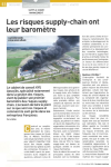
Article
Le cabinet de conseil KYU Associés, spécialisé notamment dans la gestion des risques, vient de publier son premier baromètre des risques supplychain. L’occasion de faire le point sur ce que sont ces risques et comment ils sont gérés dans les ent[...]
Article
M. Türkes ; T. Öztas ; E. Tercan ; G. Erpul ; A. Karagöz ; O. Dengiz ; O. Dogan ; K. Sahin ; B. Avcioglu |Producing a scientific desertification risk map has become one of the national primary tasks in order to effectively combat desertification in Turkey. In this respect, General Directorate of Combating Desertification and Erosion in cooperation w[...]
Chapitre d'ouvrage
E. Valette ; K. Schreiber ; D. Conaré ; V. Bonomelli ; A. Blay-Palmer ; N. Bricas ; D. Sautier ; O. Lepiller ; K. Schreiber ; D. Conaré ; V. Bonomelli ; A. Blay-Palmer ; N. Bricas ; D. Sautier ; O. Lepiller | Londres [Royaume-Uni] : Routledge | Routledge Studies in Food, Society and the Environment | 2020This chapter presents an emerging effort to develop a participatory mapping methodology that will illuminate the pathways through which sustainable urban food systems achieve lasting impact. Carried out in collaboration with Està (Economia e Sos[...]
Thèse, Mémoire, Master
Face à l’augmentation massive de l’utilisation des produits phytosanitaires, les politiques actuelles en France se mobilisent vers l’évaluation et la gestion de la pollution diffuse liée aux pratiques phytosanitaires agricoles. Le conseil agrico[...]
Série
S. Abis, dir. ; M. Brun, dir. | Paris [France] : Club Déméter | Déméter : Economie et Stratégies Agricoles, ISSN 1166-2115 | 2020L’agriculture, l’alimentation et les mondes ruraux sont au cœur des grandes questions géostratégiques et sociétales. Produire et se nourrir déterminent, en effet, les dynamiques de sécurité collective et de développement humain. La complexité de[...]
Thèse, Mémoire, Master
L’usage des pesticides a permis une amélioration des rendements. Cependant, l’utilisation excessive et parfois non raisonnée a engendré des impacts négatifs aussi bien sur l’environnement que sur la santé, ce qui pose aujourd’hui un problème de [...]
Ouvrage
L'agriculture est au coeur de la géopolitique. Combien de conflits s'enracinent dans une terre disputée ou dans une eau rare ? Combien de révoltes sont aussi celles de la faim ? Peut-on rêver de souveraineté ou de puissance sans sécurité aliment[...]
Actes de Congrès ou Communication isolée
H. Bazzi ; N. Baghdadi ; D. Ienco ; M. Zribi ; H. Belhouchette | 2020The objective of this paper is to present an approach for mapping irrigated areas at plot scale using the Sentinel-1 radar time series. Over a study site located in Catalonia region of north Spain, a dense temporal series of S1 backscattering co[...]
Actes de Congrès ou Communication isolée
H. Bazzi ; N. Baghdadi ; D. Ienco ; M. Zribi ; H. Belhouchette | 2020Irrigation plays a significant role in agricultural production in order to meet the global food requirement under changing climatic conditions. To fulfill the high demand for food with an ever-increasing global population, better planning of irr[...]
Thèse, Mémoire, Master
Ce stage se déroulera à la Chambre d'Agriculture de La Réunion, qui œuvre pour le développement de filières énergétiques au sein des exploitations agricoles réunionnaises, ainsi que pour la maîtrise de la consommation d'énergie et la production [...]
Thèse, Mémoire, Master
Les savanes de Guyane française sont un habitat naturel peu connu. Pourtant, les premières recherches montrent qu’elles abritent un patrimoine naturel, archéologique et culturel extrêmement riche. Cependant, ce milieu naturel, exploité depuis pl[...]
Rapport, Expertise, Working Paper
This work serves as the foundation for a full investigation of how stakeholders interact at the organizational and/or managerial level. The report aims to improve understanding of mandates, operational modalities, and the range of activities in [...]
Article
Organic farming has been proposed as a feasible way to reduce the environmental impacts of agriculture, provide better products to consumers, and improve farmers' income. How organic farmers are distributed worldwide, however, remains unknown. U[...]
Article
By accounting for both the supply and demand of ecosystem services (ES), it is possible to identify where ES are not able to satisfy human needs. In addition, human demands for natural resources continue to grow rapidly, risking the short supply[...]


