


Catégories

Documents disponibles dans cette catégorie (314)
 Ajouter le résultat dans votre panier Affiner la recherche
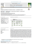
Article
Agriculture is one of the major drivers of land degradation and climate change. It is known that it can have positive impacts on provisioning ecosystem services (ES) (e.g., food production); however, it has as well detrimental effects on regulat[...]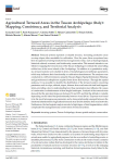
Article
L. Conti ; P. Armanasco ; C. Sottili ; S. Camiciottoli ; D. Liberto ; M. Moretta ; A. Masoni ; E. Palchetti |Terraced systems represent a valuable resource, increasing productive areas on steep slopes often unsuitable for cultivation. Over the years, these ecosystems have been recognised as having functions beyond agronomic value, such as hydrogeologic[...]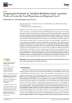
Article
Food transition has been widely inspiring regional and local food system transformation strategies to accomplish the Sustainable Development Agenda goals. Considering the urgency required to transform food systems by 2030, actions should be supp[...]
Article
O. Scammacca ; D. Montagne ; Sa. Asins-Velis ; G. Bondi ; L. Boruvka ; G. Buttafuoco ; A. Cadero ; C. Calzolari ; I. Cousin ; M. Czuba ; C. Foldal ; A. Malli ; A. Klimkowicz-Pawlas ; L. Kukk ; E. Lumini ; E. Medina-Roldán ; K. Michel ; M.J. Molina ; L. O'Sullivan ; S. Pindral ; E. Putku ; B. Kitzler ; C. Walter |Scenario analysis plays a central role in estimating how global changes affect the relationships linking ecosystem conditions and functioning to human needs. This is particularly true for agroecosystems, which are pivotal to ensure sustainable l[...]
Article
I.A.H. Yousif ; A.S.A. Sayed ; E.A. Abdelsamie ; A.A.R.S. Ahmed ; M. Saeed ; E.S. Mohamed ; N.Y. Rebouh ; M.S. Shokr |Assessing and mapping the geographical variation of soil properties is essential for precision agriculture to maintain the sustainability of the soil and plants. This study was conducted in El-Ismaillia Governorate in Egypt (arid zones), to esta[...]
Article
Citrus fruits are among the most produced and traded agricultural products worldwide, with significant economic and social importance. Despite their importance in the European Union, Middle East, and Africa, the existing literature is limited. S[...]
Article
E. Playán ; Y. Gimeno ; M.A. Lorenzo-González ; A. Jiménez ; J.R. López-Pardo ; I. Oliván ; R. Castillo ; X. Carbonell ; M. Fábregas ; L.M. Vicente ; L. Gálvez ; J.A. Lax ; D. Quílez ; M. Balcells ; D. Solano ; J. Aguaviva ; P. Paniagua ; N. Zapata |Irrigation modernization has been analyzed in the part of the Aragón region within the Ebro River Basin, in northeastern Spain. A geodatabase was built with 1144 irrigation cartographical units (ICUs) adding up to 476 k ha with access to water a[...]
Article
Global food security has been significantly affected by climate change; hence, there is a need to come up with lasting and adaptable agricultural practices. The objective of this study is to understand the relationships between climate-smart agr[...]
Article
Artificial intelligence (AI) plays an essential role in agricultural mapping. It reduces costs and time and increases efficiency in agricultural management activities, which improves the food industry. Agricultural mapping is necessary for resou[...]
Article
Social farming in Italy has not developed homogeneously. In view of this, this article adopts a multivariate analysis approach to analyse the heterogeneity and the similarities in the development paths of social farming in Italian municipalities[...]
Article
S. Chiappini ; E. Marcheggiani ; A. Galli ; A. Khosravi ; M.D.A.M. Choudhury ; M. Balestra ; D. Neri |This research examines the evolution of olive landscapes in Cartoceto, Italy, post-World War II. This study investigates the structural and functional attributes of two distinct olive cultivation models, mixed olive groves with a low tree densit[...]
Article

Ouvrage
La pandémie de la COVID-19 puis la guerre russo-ukrainienne ont placé la sécurité alimentaire au centre des préoccupations de nombreux pays. Alors que la faim était en recul jusqu'en 2014 avec 600 millions de personnes touchées, elle en concerne[...]
Thèse, Mémoire, Master
C. Grimene | 2024La préservation des ressources naturelles à travers la gestion de la pollution diffuse liée à l’utilisation des produits phytosanitaires en agriculture est considérée ces dernières années et depuis le grenelle environnement lancé en 2007 comme u[...]
Série
S. Abis, dir. ; A. Marie, coord. | Paris [France] : Club Déméter | Déméter : Economie et Stratégies Agricoles, ISSN 1166-2115 | 2024Une double ébullition, politique et environnementale, frappe la planète. La marche de ce monde en pleine transformation s’avère complexe à décrypter. De nouveaux jeux de pouvoir déstructurent le multilatéralisme et redessinent la carte des relat[...]
Ouvrage
Comment s’imaginer le monde de demain ? Comment le représenter ? Quels vont être les impacts sur notre vie des changements climatiques, des crises migratoires, des inégalités qui se creusent, des guerres à venir ? Raconter demain, réfléchir [...]
Article
T. Mabhaudhi ; T.L. Dirwai ; C. Taguta ; A. Sikka ; J. Lautze |While there is a proliferation of Decision Support Tools (DSTs) to enhance agricultural water productivity (AWP) and related objectives such as food security, an assessment of their adoption and performance is not known to be undertaken. To deve[...]
Article
Agriculture plays a dual role in the conservation of European biodiversity, as extensive agricultural lands provide habitats for more than half of Europe's species, but intensification and abandonment of farmland threaten these species' habitats[...]
Article
The present study aims to support the Mapping and Assessment of Ecosystems and their Services (MAES) implementation in Greece, by synthesizing an indicator that could be used for abiotic attribute assessments and specifically for geodiversity. S[...]
Article
CONTEXT The Mediterranean basin and specifically Northeast Italy are recognised as climate change hotspots. The latter is a key socio-economic area in Europe among the most agriculturally productive. However, increasingly frequent drought period[...]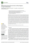
Article
The terroir effect refers to the interactions between the grapes and their natural surroundings and has been recognized as an important factor in wine quality. The identification and mapping of viticultural terroir have long been relying on expe[...]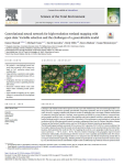
Article
K. Mainali ; M. Evans ; D. Saavedra ; E. Mills ; B. Madsen ; S. Minnemeyer |Landscape scale wetland conservation requires accurate, up-to-date wetland maps. The most useful approaches to creating such maps are automated, spatially generalizable, temporally repeatable, and can be applied at large spatial scales. However,[...]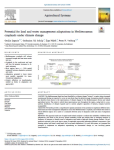
Article
C. Zagaria ; C.J.E. Schulp ; Z. Malek ; P.H. Verburg |CONTEXT The Mediterranean Basin has been identified as a climate change 'hotspot', a region where increased warming and drying are expected to occur at rates faster than the global average. Increasing scientific attention has therefore been draw[...]
Série
S. Abis, dir. ; A. Marie, coord. | Paris [France] : Club Déméter | Déméter : Economie et Stratégies Agricoles, ISSN 1166-2115 | 2023L’agriculture et l’alimentation sont au cœur des défis contemporains et des solutions de demain. Toujours déterminantes pour la sécurité collective et l’existence de chacune et chacun, elles conditionnent les trajectoires de développement durabl[...]
Ouvrage
L'agriculture est au coeur de la géopolitique. Combien de conflits s'enracinent dans une terre disputée ou dans une eau rare ? Combien de révoltes sont aussi celles de la faim ? Peut-on rêver de souveraineté ou de puissance sans sécurité aliment[...]
Actes de Congrès ou Communication isolée
S. El Harche ; M. Chikhaoui ; N. Mustapha | 2023Land cover and soil maps are widely used in hydrological modeling studies, and serve as a critical foundation for many applications around the world. The Food and Agriculture Organization (FAO) and the European Space Agency and Climate Change In[...]
Article
The GIAHS-FAO program enhances the agricultural systems coevolved with humans through their dynamic conservation to guarantee the livelihood of future generations. The aim of this research was to assess, with a dynamic perspective, the terraced [...]
Article
G. Cecili ; P. De Fioravante ; L. Congedo ; M. Marchetti ; M. Munafò |In recent years, deep learning (DL) algorithms have been widely integrated for remote sensing image classification, but fewer studies have applied it for land consumption (LC). LC is the main factor in land transformation dynamics and it is the [...]
Article
Parcel-level cropland maps are an essential data source for crop yield estimation, precision agriculture, and many other agronomy applications. Here, we proposed a rice field mapping approach that combines agricultural field boundary extraction [...]
Article
Z. Pinke ; B. Decsi ; M.K. Kardos ; Z. Kern ; Z. Kozma ; L. Pásztor ; T. Ács |The warming of the climate and shrinking freshwater resources pose serious challenges to European agriculture. Meeting these challenges demands a thorough knowledge of the major trends in soil moisture patterns across the continent over time. Ch[...]


