


Catégories

Documents disponibles dans cette catégorie (174)
 trié(s) par Date édition décroissante (Année d'édition décroissant(e)) Ajouter le résultat dans votre panier Affiner la recherche
Article
CONTEXT The Mediterranean basin and specifically Northeast Italy are recognised as climate change hotspots. The latter is a key socio-economic area in Europe among the most agriculturally productive. However, increasingly frequent drought period[...]
Article
K. Mainali ; M. Evans ; D. Saavedra ; E. Mills ; B. Madsen ; S. Minnemeyer |Landscape scale wetland conservation requires accurate, up-to-date wetland maps. The most useful approaches to creating such maps are automated, spatially generalizable, temporally repeatable, and can be applied at large spatial scales. However,[...]
Article
The terroir effect refers to the interactions between the grapes and their natural surroundings and has been recognized as an important factor in wine quality. The identification and mapping of viticultural terroir have long been relying on expe[...]
Série
S. Abis, dir. ; A. Marie, coord. | Paris [France] : Club Déméter | Déméter : Economie et Stratégies Agricoles, ISSN 1166-2115 | 2023L’agriculture et l’alimentation sont au cœur des défis contemporains et des solutions de demain. Toujours déterminantes pour la sécurité collective et l’existence de chacune et chacun, elles conditionnent les trajectoires de développement durabl[...]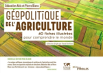
Ouvrage
L'agriculture est au coeur de la géopolitique. Combien de conflits s'enracinent dans une terre disputée ou dans une eau rare ? Combien de révoltes sont aussi celles de la faim ? Peut-on rêver de souveraineté ou de puissance sans sécurité aliment[...]
Article
The present study aims to support the Mapping and Assessment of Ecosystems and their Services (MAES) implementation in Greece, by synthesizing an indicator that could be used for abiotic attribute assessments and specifically for geodiversity. S[...]
Article
Agriculture plays a dual role in the conservation of European biodiversity, as extensive agricultural lands provide habitats for more than half of Europe's species, but intensification and abandonment of farmland threaten these species' habitats[...]
Article
T. Mabhaudhi ; T.L. Dirwai ; C. Taguta ; A. Sikka ; J. Lautze |While there is a proliferation of Decision Support Tools (DSTs) to enhance agricultural water productivity (AWP) and related objectives such as food security, an assessment of their adoption and performance is not known to be undertaken. To deve[...]
Article
C. Zagaria ; C.J.E. Schulp ; Z. Malek ; P.H. Verburg |CONTEXT The Mediterranean Basin has been identified as a climate change 'hotspot', a region where increased warming and drying are expected to occur at rates faster than the global average. Increasing scientific attention has therefore been draw[...]
Actes de Congrès ou Communication isolée
S. El Harche ; M. Chikhaoui ; N. Mustapha | 2023Land cover and soil maps are widely used in hydrological modeling studies, and serve as a critical foundation for many applications around the world. The Food and Agriculture Organization (FAO) and the European Space Agency and Climate Change In[...]
Article
Parcel-level cropland maps are an essential data source for crop yield estimation, precision agriculture, and many other agronomy applications. Here, we proposed a rice field mapping approach that combines agricultural field boundary extraction [...]
Thèse, Mémoire, Master
La cameline, plante oléagineuse qui trouve ses origines en Europe, résistante à la sécheresse, dotée d'une forte capacité d'adaptation et d'un cycle végétatif court, offre une diversité de débouchés pour l'ensemble de ces parties. Cette étude ex[...]
Article
F.Z. Echogdali ; S. Boutaleb ; A. Bendarma ; M.E. Saidi ; M. Aadraoui ; M. Abioui ; M. Ouchchen ; K. Abdelrahman ; M.S. Fnais ; K.S. Sajinkumar |Ensuring water availability for agriculture and drinking water supply in semi-arid mountainous regions requires control of factors influencing groundwater availability. In most cases, the population draws its water needs from the alluvial aquife[...]
Article
Le Liban est un pays méditerranéen avec une superficie de 10 452 km2, dont 65 % sont karstiques, il est considéré riche en eaux superficielles et souterraines, mais en dépit de cette richesse, le Liban montre une pénurie en eau à cause de [...]
Article
The GIAHS-FAO program enhances the agricultural systems coevolved with humans through their dynamic conservation to guarantee the livelihood of future generations. The aim of this research was to assess, with a dynamic perspective, the terraced [...]
Article
Z. Pinke ; B. Decsi ; M.K. Kardos ; Z. Kern ; Z. Kozma ; L. Pásztor ; T. Ács |The warming of the climate and shrinking freshwater resources pose serious challenges to European agriculture. Meeting these challenges demands a thorough knowledge of the major trends in soil moisture patterns across the continent over time. Ch[...]
Article
In arid and semi-arid regions, agriculture is an important element of the national economy, but this sector is a large consumer of water. In a context of high pressure on water resources, appropriate management is required. In semi-arid, intensi[...]
Article
Accurate information about the irrigated surface is essential to help assess the impact of irrigation on water consumption, the hydrological cycle and regional climate. In this study, we compare recently developed operational and spatially trans[...]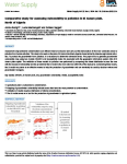
Article
Assessment of groundwater contamination is an efficient means to discover and carry out the demarcation of the more vulnerable zones to pollution from human activities. This study is focused on the plain of El Asnam (Northern Algeria) characteri[...]
Article
La structuration locale d’une filière de revalorisation d’invendus se met en mouvement par une mise en réseau d’acteurs autour d’un projet de territoire à Nantes. En travaillant auprès des porteurs de projets, les chercheurs travaillent depuis d[...]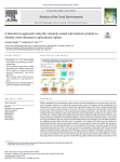
Article
Effective agricultural water management requires accurate and timely identification of crop water stress at the farm-scale for irrigation advisories or to allocate the optimal amount of water for irrigation. Various drought indices are being uti[...]
Série
S. Abis, dir. ; M. Brun, dir. | Paris [France] : Club Déméter | Déméter : Economie et Stratégies Agricoles, ISSN 1166-2115 | 2022Manger est au cœur de dynamiques politiques, géoéconomiques et environnementales. Cet acte du quotidien, essentiel pour certains et banal pour d’autres, est de plus en plus façonné par de nouveaux acteurs, des innovations inédites et des attente[...]
Article
One important issue faced by wheat producers is temporal and spatial yield variation management at a within-field scale. Vegetation indices derived from remote-sensing platforms, such as Landsat, can provide vital information characterising this[...]
Article
The soil profile and its spatial distribution are two essential aspects for promoting sustainable agriculture, with precise inputs in quantity, space, and time. This work’s objective was to elaborate a digital map of soil fertility considering t[...]
Article
La dégradation des terres est un problème préoccupant et d’actualité dans plusieurs régions du monde. Il représente toujours un thème de recherche d’actualité en géographie. Cet intérêt prend de l’importance surtout avec l’avènement du changemen[...]
Article
The Geographical Indications (GIs) scheme is the EU’s primary policy tool for increasing the market values of geographically distinct food products. Although GIs are linked to the landscapes of food production, little is known about the social-e[...]
Article
Desertification is a serious threat to human survival and to ecosystems, especially to inland desert oases. An assessment of desertification severity is essential to ensure national sustainable development for agricultural and land expansion pro[...]
Thèse, Mémoire, Master
S. Saad | 2022Today, technology is an important vector of economic and environmental performance in agriculture. It provides innovative solutions to increase the efficiency of orchards and help in decision-making. Therefore, Blue whale being the leading compa[...]
Article
The study involved an in-depth analysis of the main land cover and land use data available nationwide for the Italian territory, in order to produce a reliable cartography for the evaluation of ecosystem services. In detail, data from the land m[...]
Article
A. Dornik ; M.A. Chetan ; L. Dragut ; A. Iliuta ; D.D. Dicu |Land suitability assessment (LSA) provides geospatial information about growing crops where they are best suited and can play a crucial role in addressing contemporary challenges such as feeding 9 billion people by 2050, coping with climate chan[...]
Article
G. Cecili ; P. De Fioravante ; L. Congedo ; M. Marchetti ; M. Munafò |In recent years, deep learning (DL) algorithms have been widely integrated for remote sensing image classification, but fewer studies have applied it for land consumption (LC). LC is the main factor in land transformation dynamics and it is the [...]
Article
We are currently living in the era of big data. The volume of collected or archived geospatial data for land use and land cover (LULC) mapping including remotely sensed satellite imagery and auxiliary geospatial datasets is increasing. Innovativ[...]
Article
Agriculture has been identified as one of the main drivers of environmental degradation in the European Union (EU). It can have negative impacts on air, water, soil and biodiversity. The condition of agroecosystems is affected by soil degradatio[...]
Article
L. Battisti ; F. Larcher ; S. Grella ; N. Di Bartolo ; M. Devecchi |The Natura 2000 network is an ecological network covering the whole territory of the European Union to ensure the long-term maintenance of threatened or rare natural habitats and species of flora and fauna, including in metropolitan and rural ar[...]
Ouvrage
Mapping and Forecasting Land Use: The Present and Future of Planning is a comprehensive reference on the use of technologies to map land use, focusing on GIS and remote sensing applications and methodologies for land use monitoring. This book ad[...]
Article
Global environmental changes, including landscape fragmentation, are threatening the integrity of ecosystems and reducing their capacity to deliver ecosystem services. Spatial configuration of a green network supports ecological functions and se[...]
Article
Groundwater is a vital water resource for economic, agricultural, and domestic purposes in arid regions. To reduce water scarcity in arid regions, recently, remote sensing and GIS techniques have been successfully applied to predict areas with p[...]
Article
For more than 30 years, the LEADER approach has been a key tool in the endogenous, local, participatory, and sustainable development of the most disadvantaged European rural areas in demographic and socioeconomic terms. However, despite the unqu[...]
Article
S. Hakkou ; M. Sabir ; N. Machouri |Les truffes constituent au Maroc une ressource naturelle importante pour l’économie rurale et peuvent jouer un rôle important dans l’allégement de la pression sur les ressources forestières et pastorales. Cependant, on note un manque de connaiss[...]
Article
A. Moumane ; J. Al Karkouri ; A. Benmansour ; F.E. El Ghazali ; J. Fico ; A. Karmaoui ; M. Batchi |Landsat time-series with 10-year intervals from 1991 to 2021 were used to extract information on land use and land cover (LULC) changes in the Ternata oasis over the past thirty years by using maximum likelihood classification (MLC) and the norm[...]
Article
Novel spatial models for appraising arable land resources using data processing techniques can increase insight into agroecosystem services. Hence, the principal component analysis (PCA), hierarchal cluster analysis (HCA), analytical hierarchy p[...]
Article
R. Salvia ; A. Colantoni ; L. Bianchini ; G. Egidi ; G. Polinesi ; L. Salvati ; G. Quaranta |Although sustainable development and desertification risk are hegemonic concepts in environmental economics, their intimate relationship was occasionally studied and made spatially explicit. The present study contributes to fill this knowledge g[...]
Article
Agricultural water appropriation has undergone rapid changes in recent decades, but estimates of global water appropriation have not been updated with the latest data and consistent methods. Documenting these changes is challenging given the het[...]
Article
Soil, a non-renewable resource, sustains life on Earth by supporting around 95% of global food production and providing ecosystem services such as biomass production, filtration of contaminants and transfer of mass and energy between spheres. Un[...]
Article
E. Madene ; A. Boufekane ; M. Meddi ; G. Busico ; A. Zghibi |The proposed study aims to assess groundwater quality and suitability of the Upper and Middle Cheliff plains (northwest of Algeria) for irrigation and drinking. Here the groundwater is the main source for domestic, agricultural and industrial ac[...]
Article
C. Grimene ; O. Mghirbi ; S. Louvet ; J.-P. Bord ; P. Le Grusse |The preservation of natural resources via the management of diffuse pollution is currently considered to be a significant challenge in France. Pollution reduction policies are notably based on the identification of vulnerable areas. In this cont[...]
E-Book
Cet ouvrage expose les fondements théoriques indispensables à l’utilisation des systèmes d’information géographique (SIG) en présentant de manière simple les modèles vecteur et raster, les standards OGC, le SQL spatial ou les modèles numériques [...]
Article
N. Debonne ; M. Bürgi ; V. Diogo ; J. Helfenstein ; F. Herzog ; C. Levers ; F. Mohr ; R. Swart ; P.H. Verburg |A range of intensifying pressures is making the future of European agriculture dynamic and contested. Insights into these pressures are needed to inform debates about the future of the sector. In this study, we use a foresight approach to identi[...]
Article
M. Barbouchi ; R. Lhissou ; R. Abdelfattah ; A. El Alem ; K. Chokmani ; N. Ben Aissa ; H. Cheikh M‘hamed ; M. Annabi ; H. Bahri |The monitoring of cereal productions, mainly through yield estimations, has played an important role in providing reliable information to decision makers in order to ensure the proper management of agricultural markets. In this context, remote s[...]
Thèse, Mémoire, Master
La Région Nouvelle-Aquitaine est positionnée en faveur de l’agroécologie. Elle accueille de nombreux projets agroécologiques collectifs et se caractérise par une large palette de configurations territoriales au profit de la transition agroécolog[...]


