


Catégories

Documents disponibles dans cette catégorie (174)
 Ajouter le résultat dans votre panier Affiner la recherche
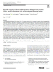
Article
The Geographical Indications (GIs) scheme is the EU’s primary policy tool for increasing the market values of geographically distinct food products. Although GIs are linked to the landscapes of food production, little is known about the social-e[...]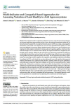
Article
Novel spatial models for appraising arable land resources using data processing techniques can increase insight into agroecosystem services. Hence, the principal component analysis (PCA), hierarchal cluster analysis (HCA), analytical hierarchy p[...]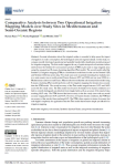
Article
Accurate information about the irrigated surface is essential to help assess the impact of irrigation on water consumption, the hydrological cycle and regional climate. In this study, we compare recently developed operational and spatially trans[...]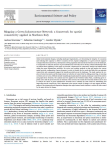
Article
Global environmental changes, including landscape fragmentation, are threatening the integrity of ecosystems and reducing their capacity to deliver ecosystem services. Spatial configuration of a green network supports ecological functions and se[...]
Article
A. Moumane ; J. Al Karkouri ; A. Benmansour ; F.E. El Ghazali ; J. Fico ; A. Karmaoui ; M. Batchi |Landsat time-series with 10-year intervals from 1991 to 2021 were used to extract information on land use and land cover (LULC) changes in the Ternata oasis over the past thirty years by using maximum likelihood classification (MLC) and the norm[...]
Article
E. Madene ; A. Boufekane ; M. Meddi ; G. Busico ; A. Zghibi |The proposed study aims to assess groundwater quality and suitability of the Upper and Middle Cheliff plains (northwest of Algeria) for irrigation and drinking. Here the groundwater is the main source for domestic, agricultural and industrial ac[...]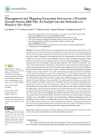
Article
L. Battisti ; F. Larcher ; S. Grella ; N. Di Bartolo ; M. Devecchi |The Natura 2000 network is an ecological network covering the whole territory of the European Union to ensure the long-term maintenance of threatened or rare natural habitats and species of flora and fauna, including in metropolitan and rural ar[...]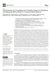
Article
M. Barbouchi ; R. Lhissou ; R. Abdelfattah ; A. El Alem ; K. Chokmani ; N. Ben Aissa ; H. Cheikh M‘hamed ; M. Annabi ; H. Bahri |The monitoring of cereal productions, mainly through yield estimations, has played an important role in providing reliable information to decision makers in order to ensure the proper management of agricultural markets. In this context, remote s[...]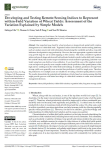
Article
One important issue faced by wheat producers is temporal and spatial yield variation management at a within-field scale. Vegetation indices derived from remote-sensing platforms, such as Landsat, can provide vital information characterising this[...]
Article
The soil profile and its spatial distribution are two essential aspects for promoting sustainable agriculture, with precise inputs in quantity, space, and time. This work’s objective was to elaborate a digital map of soil fertility considering t[...]
Article
La dégradation des terres est un problème préoccupant et d’actualité dans plusieurs régions du monde. Il représente toujours un thème de recherche d’actualité en géographie. Cet intérêt prend de l’importance surtout avec l’avènement du changemen[...]
Article
Agriculture has been identified as one of the main drivers of environmental degradation in the European Union (EU). It can have negative impacts on air, water, soil and biodiversity. The condition of agroecosystems is affected by soil degradatio[...]
Article
R. Salvia ; A. Colantoni ; L. Bianchini ; G. Egidi ; G. Polinesi ; L. Salvati ; G. Quaranta |Although sustainable development and desertification risk are hegemonic concepts in environmental economics, their intimate relationship was occasionally studied and made spatially explicit. The present study contributes to fill this knowledge g[...]
Article
Soil, a non-renewable resource, sustains life on Earth by supporting around 95% of global food production and providing ecosystem services such as biomass production, filtration of contaminants and transfer of mass and energy between spheres. Un[...]
Thèse, Mémoire, Master
La cameline, plante oléagineuse qui trouve ses origines en Europe, résistante à la sécheresse, dotée d'une forte capacité d'adaptation et d'un cycle végétatif court, offre une diversité de débouchés pour l'ensemble de ces parties. Cette étude ex[...]
Article
Le Liban est un pays méditerranéen avec une superficie de 10 452 km2, dont 65 % sont karstiques, il est considéré riche en eaux superficielles et souterraines, mais en dépit de cette richesse, le Liban montre une pénurie en eau à cause de [...]
Série
S. Abis, dir. ; M. Brun, dir. | Paris [France] : Club Déméter | Déméter : Economie et Stratégies Agricoles, ISSN 1166-2115 | 2022Manger est au cœur de dynamiques politiques, géoéconomiques et environnementales. Cet acte du quotidien, essentiel pour certains et banal pour d’autres, est de plus en plus façonné par de nouveaux acteurs, des innovations inédites et des attente[...]
Article
Desertification is a serious threat to human survival and to ecosystems, especially to inland desert oases. An assessment of desertification severity is essential to ensure national sustainable development for agricultural and land expansion pro[...]
Thèse, Mémoire, Master
S. Saad | 2022Today, technology is an important vector of economic and environmental performance in agriculture. It provides innovative solutions to increase the efficiency of orchards and help in decision-making. Therefore, Blue whale being the leading compa[...]
Article
The study involved an in-depth analysis of the main land cover and land use data available nationwide for the Italian territory, in order to produce a reliable cartography for the evaluation of ecosystem services. In detail, data from the land m[...]
Ouvrage
Mapping and Forecasting Land Use: The Present and Future of Planning is a comprehensive reference on the use of technologies to map land use, focusing on GIS and remote sensing applications and methodologies for land use monitoring. This book ad[...]
Article
C. Grimene ; O. Mghirbi ; S. Louvet ; J.-P. Bord ; P. Le Grusse |The preservation of natural resources via the management of diffuse pollution is currently considered to be a significant challenge in France. Pollution reduction policies are notably based on the identification of vulnerable areas. In this cont[...]
E-Book
Cet ouvrage expose les fondements théoriques indispensables à l’utilisation des systèmes d’information géographique (SIG) en présentant de manière simple les modèles vecteur et raster, les standards OGC, le SQL spatial ou les modèles numériques [...]
Thèse, Mémoire, Master
La Région Nouvelle-Aquitaine est positionnée en faveur de l’agroécologie. Elle accueille de nombreux projets agroécologiques collectifs et se caractérise par une large palette de configurations territoriales au profit de la transition agroécolog[...]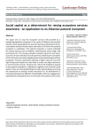
Article
This paper aims to map the ecosystem services (ES) provided by a reputed agropastoral ecosystem in the south of Albania and ascertain whether social capital affects the level of importance attributed to them. A perception analysis of both buyers[...]


