


Catégories
|
Thésaurus IAMM > RELEVE DES DONNEES > TELEDETECTION
TELEDETECTIONSynonyme(s)Détection à distance ;Image spot Image landsatVoir aussi |

Documents disponibles dans cette catégorie (93)
 trié(s) par Date édition décroissante (Année d'édition décroissant(e)) Ajouter le résultat dans votre panier Affiner la recherche
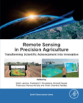
Ouvrage
S. Lamine ; P.K. Srivastava ; A. Kayad ; F. Muñoz-Arriola ; P.C. Pandey | Oxford [Royaume-Uni] : Academic Press | Earth Observation Series | 2024Remote Sensing in Precision Agriculture: Transforming Scientific Advancement into Innovation compiles the latest applications of remote sensing in agriculture using spaceborne, airborne and drones’ geospatial data. The book presents case studies[...]
Article
The integration of remote sensing and socio-economic data is crucial for policy making in regions suffering from water scarcity and climate change. We present a framework that combines remotely sensed estimates of biomass and water use from FAO'[...]
Article
K. Mainali ; M. Evans ; D. Saavedra ; E. Mills ; B. Madsen ; S. Minnemeyer |Landscape scale wetland conservation requires accurate, up-to-date wetland maps. The most useful approaches to creating such maps are automated, spatially generalizable, temporally repeatable, and can be applied at large spatial scales. However,[...]
Actes de Congrès ou Communication isolée
S. El Harche ; M. Chikhaoui ; N. Mustapha | 2023Land cover and soil maps are widely used in hydrological modeling studies, and serve as a critical foundation for many applications around the world. The Food and Agriculture Organization (FAO) and the European Space Agency and Climate Change In[...]
Article
A. Karmaoui ; A. Moumane ; S. El Jaafari ; A. Menouni ; J. Al Karkouri ; M. Yacoubi ; L. Hajji |Remote sensing (RS) data and geographic information system (GIS) techniques were used to monitor the changes in the Oasis agroecosystem of the pre-Saharan province of Errachidia, southeastern Morocco. The land use and land cover (LULC) change of[...]
Article
F.Z. Echogdali ; S. Boutaleb ; A. Bendarma ; M.E. Saidi ; M. Aadraoui ; M. Abioui ; M. Ouchchen ; K. Abdelrahman ; M.S. Fnais ; K.S. Sajinkumar |Ensuring water availability for agriculture and drinking water supply in semi-arid mountainous regions requires control of factors influencing groundwater availability. In most cases, the population draws its water needs from the alluvial aquife[...]
Article
In arid and semi-arid regions, agriculture is an important element of the national economy, but this sector is a large consumer of water. In a context of high pressure on water resources, appropriate management is required. In semi-arid, intensi[...]
Article
Effective agricultural water management requires accurate and timely identification of crop water stress at the farm-scale for irrigation advisories or to allocate the optimal amount of water for irrigation. Various drought indices are being uti[...]
Article
Considering the importance of rainfed agriculture in adaptation to nature and long-term sustainability in the human food supply and livelihood of farmers, the main purpose of this study is to investigate the potential of rainfed agriculture in t[...]
Article
Scarcity of water has emerged as a major problem globally due to climate change and population growth, especially in semi-arid and arid regions. Egypt is currently experiencing serious water challenges due to its limited water resources. The wat[...]
Article
One important issue faced by wheat producers is temporal and spatial yield variation management at a within-field scale. Vegetation indices derived from remote-sensing platforms, such as Landsat, can provide vital information characterising this[...]
Article
K. Khemiri ; S. Jebari ; N. Mahdhi ; I. Saidi ; R. Berndtsson ; S. Bacha |Increasing land use pressure is a primary force for degradation of agricultural areas. The drivers for these pressures are initiated by a series of interconnected processes. This study presents a novel methodology to analyze drivers of changing [...]
Article
R.S. Makar ; S.A. Shahin ; M. El-Nazer ; A. Wheida ; M. Abd El-Hady |Climate change and its impact on agriculture and water resources have become a global concern. The implications of extreme weather events on food production and water resource availability are starting to have social and economic effects worldwi[...]
Article
J. Elfarkh ; V. Simonneaux ; L. Jarlan ; J. Ezzahar ; G. Boulet ; A. Chakir ; S. Er-Raki |Quantification of actual crop evapotranspiration (ETa) over large areas is a critical issue to manage water resources, particularly in semi-arid regions. In this study, four models driven by high resolution remote sensing data were intercompared[...]
Article
R. Gamal ; M. El-Shirbeny ; A. Abou-Hadid ; A. Swelam ; A.-G. El-Gindy ; Y. Arafa ; V. Nangia |Evapotranspiration (ET) is a significant consumer of irrigation water and precipitation on cropland. Global and regional interest in the sustainable management of limited freshwater supplies to meet the rapidly increasing population and food dem[...]
E-Book
H. Rey-Valette ; C. Jabbour ; P. Maurel ; J.-M. Salles | Versailles [France] : Editions Quae | Guide Pratique | 2022Les demandes et les usages des données spatiales satellitaires se développent et se diversifient de façon importante, en lien avec la précision, la fréquence des prises de vue et la taille des images. Ainsi, il convient de comprendre et de rendr[...]
Article
Climate change, drought, and anthropogenic effects are among the main drivers causing alterations in natural resources one of which is the lake level (LL) of large saline lakes, which are mainly located in arid and semi-arid regions. As an urgen[...]
Article
G. Cecili ; P. De Fioravante ; L. Congedo ; M. Marchetti ; M. Munafò |In recent years, deep learning (DL) algorithms have been widely integrated for remote sensing image classification, but fewer studies have applied it for land consumption (LC). LC is the main factor in land transformation dynamics and it is the [...]
Article
We are currently living in the era of big data. The volume of collected or archived geospatial data for land use and land cover (LULC) mapping including remotely sensed satellite imagery and auxiliary geospatial datasets is increasing. Innovativ[...]
Article
The demand for food based on intensive agriculture has decreased soil quality, posing great challenges such as increasing agricultural productivity and promoting environmental sustainability. Thus, researchers have focused on developing models f[...]
Article
J. Wang ; M. Bretz ; M.A.A. Dewan ; M.A. Delavar |Land-use and land-cover change (LULCC) are of importance in natural resource management, environmental modelling and assessment, and agricultural production management. However, LULCC detection and modelling is a complex, data-driven process in [...]
Ouvrage
Mapping and Forecasting Land Use: The Present and Future of Planning is a comprehensive reference on the use of technologies to map land use, focusing on GIS and remote sensing applications and methodologies for land use monitoring. This book ad[...]
Article
Groundwater is a vital water resource for economic, agricultural, and domestic purposes in arid regions. To reduce water scarcity in arid regions, recently, remote sensing and GIS techniques have been successfully applied to predict areas with p[...]
Article
Cet article propose de réinscrire le couplage entre les technologies numériques issues de l’observation spatiale et les pratiques agricoles dans une histoire longue. Il revient sur les efforts déployés par le Centre national d’études spatiales, [...]
Article
Drought is considered one of the key barriers influencing wheat production, and various adaptation schemes are practiced globally to mitigate drought impacts. However, it is difficult to precisely assess the performances of drought mitigation me[...]
Article
This work was initiated in 2019 within the FAO WEPS project framework (2018–2022), aiming to determine the Water Productivity (WP) of the Tunisian olive orchards combining two scales of measurements for soil moisture determination: one for the g[...]
Article
J.T. Al-Bakri ; G. D'Urso ; C. Batchelor ; M. Abukhalaf ; A. Alobeiaat ; A. Al-Khreisat ; D. Vallée |Remote sensing can provide important and updated information for agricultural water accounting (AWA). In this study, data from the open-access portal (WaPOR) of the Food and Agricultural Organization was used in AWA to assess levels of agricultu[...]
Article
A. Pradipta ; P. Soupios ; N. Kourgialas ; M. Doula ; Z. Dokou ; M. Makkawi ; M. Alfarhan ; B. Tawabini ; P. Kirmizakis ; M. Yassin |Sustainable agriculture management typically requires detailed characterization of physical, chemical, and biological aspects of soil properties. These properties are essential for agriculture and should be determined before any decision for cro[...]
Article
Salinization is a major soil degradation threat in irrigated lands worldwide. In Portugal, it affects several pockets of irrigated agricultural areas, but the spatial distribution and intensity of soil salinity are not well known. Unlike convent[...]
Article
The existing cultivated land in the Mediterranean region faces great pressure from various sources. A suitability evaluation of potential arable land is urgent for helping adaptation measures to mitigate the impacts of climate change and human p[...]
E-Book
Cet ouvrage expose les fondements théoriques indispensables à l’utilisation des systèmes d’information géographique (SIG) en présentant de manière simple les modèles vecteur et raster, les standards OGC, le SQL spatial ou les modèles numériques [...]
Article
M. Barbouchi ; R. Lhissou ; R. Abdelfattah ; A. El Alem ; K. Chokmani ; N. Ben Aissa ; H. Cheikh M‘hamed ; M. Annabi ; H. Bahri |The monitoring of cereal productions, mainly through yield estimations, has played an important role in providing reliable information to decision makers in order to ensure the proper management of agricultural markets. In this context, remote s[...]
Article
Agro-management zones recently became the backbone of modern agriculture. Delineating management zones for Variable-Rate Fertilization (VRF) can provide important ecological benefits and better sustainability of the new Egyptian farming projects[...]
Article
Use of Sentinel-2 Satellite for spatially variable rate fertiliser management in a sicilian vineyard
Satellites can be used for producing maps of within-field crop and soil parameters and, consequentially, spatially variable rate crop input application maps. The plant vegetative vigour index (i.e., Normalised Difference Vegetation Index—NDVI) a[...]
Article
A. Alitane ; A. Essahlaoui ; M. El Hafyani ; A. El Hmaidi ; A. El Ouali ; A. Kassou ; Y. El Yousfi ; A. Van Griensven ; C.J. Chawanda ; A. Van Rompaey |Soil erosion is an increasingly issue worldwide, due to several factors including climate variations and humans’ activities, especially in Mediterranean ecosystems. Therefore, the aim of this paper is: (i) to quantify and to predict soil erosion[...]
Article
N.N. Kourgialas ; A. Hliaoutakis ; A.V. Argyriou ; G. Morianou ; A.E. Voulgarakis ; E. Kokinou ; I.N. Daliakopoulos ; D. Kalderis ; K. Tzerakis ; G. Psarras ; N. Papadopoulos ; T. Manios ; A. Vafidis ; P. Soupios |The aim of this paper is the creation of an integrated and free-access web platform for parcel irrigation water management on a large spatial scale (Water District of Crete, in Greece) in order to: a) accurately determine the irrigation needs of[...]
Ouvrage
Agricultural Water Management: Theories and Practices advances the scientific understanding, development and application of agricultural water management through an integrated approach. This book presents a collection of recent developments and [...]
Ouvrage
M. Abu-Hashim, ed. ; F.K. Allouche, ed. ; A. Negm, ed. | Cham [Suisse] : Springer | Springer Water | 2021This book focuses on the status quo and the latest information on the water-soil-agriculture nexus in the MENA countries. It presents several case studies and applications from e.g. Morocco, Algeria, Tunisia, Egypt and Jordan, while also sharing[...]
Article
Egypt suffers from severe water scarcity, which affects the sustainability of agricultural production. Therefore, the sustainable use of available water resources under water scarcity requires the adoption of water allocation policies favoring c[...]
Article
Artificial neural networks are one of the most important elements of machine learning and artificial intelligence. They are inspired by the human brain structure and function as if they are based on interconnected nodes in which simple processin[...]
Article
N. Guiomar ; S. Godinho ; M. Rivera ; T. Pinto-Correia ; R. Machado ; M. Czekaj ; E. Tyran ; J. Puchala |Recent findings on the contribution of smallholders to global food production and security challenge the values used in several reports of international organizations. The skewed distribution of the number of farms and the agricultural area by f[...]
Article
Z. Moumen ; I. Elhassnaoui ; W. Khaddi ; M.A. Wahba ; A. Lahrach |Future projection shows that the availability of freshwater per capita will decrease to 560 m3/year by 2030 in Morocco. In this realm of adopting efficient irrigation, alternatives become a priority to overcome water shortage. The presente[...]
Article
This paper is a first attempt to compute the total water needs of an agricultural plain with remote sensing and ground data in Iran. The cropping areas were mapped with Sentinels-2 images, based on NDVI profiles classification. This model was va[...]
Article
Improvements in the sustainability of agricultural production depend essentially on advances in the efficient use of nitrogen. Precision farming promises solutions in this respect. Variable rate technologies allow the right quantities of fertili[...]
Article
De nombreuses techniques d'estimation du rendement des cultures sont utilisées. La plus efficace repose sur l'utilisation de données géo spatiales et de technologies telles que la télédétection, notamment dans des conditions de la présente étude[...]
Article
R. Ikkou ; H. Lazhar ; Y. Benbrahim |La forêt d'Itzer s'inscrit dans le cadre géographique du versant Sud du Moyen Atlas Plissé, région où la dégradation de la couverture végétale est terriblement présente. L'utilisation de l’imagerie satellitaire (Landsat) nous a permis d’avoir un[...]
Actes de Congrès ou Communication isolée
H. Bazzi ; N. Baghdadi ; I. Fayad ; M. Zribi ; V. Demarez ; Y. Pageot ; H. Belhouchette | 2021Better management of water consumption in irrigated agriculture is essential in order to save water resources. The objective of this study is to propose a new model capable of detecting the irrigation events using the Sentinel-1 (S1) Cband SAR ([...]
Article
Digital Twins are very promising to bring smart farming to new levels of farming productivity and sustainability. A Digital Twin is a digital equivalent of a real-life object of which it mirrors its behaviour and states over its lifetime in a vi[...]
Article
Le bassin versant de l’Oued Guigou connait des facteurs d’évolution généraux. Jusqu’à une époque récente, aucune menace significative n’a pesé sur la stabilité de ce bassin versant. Aujourd’hui, cet équilibre est devenu précaire et on peut voir [...]
Article
Agricultural expansion areas in the Egyptian deserts are one of the main governmental inputs that increased during the last decade. Evaluation of such agricultural lands helps decision makers in strategic planning of future projects. The present[...]


