


Catégories
|
Thésaurus IAMM > SYSTEME D'INFORMATION > SYSTEME D'INFORMATION GEOGRAPHIQUE
SYSTEME D'INFORMATION GEOGRAPHIQUESynonyme(s)Sig |

Documents disponibles dans cette catégorie (87)
 Ajouter le résultat dans votre panier Affiner la recherche
Article
Y.M. Youssef ; K.S. Gemail ; H.M. Atia ; M. Mahdy |The destabilization of delta's worldwide due to climate change and human activities presents challenges in meeting the growing demands for freshwater and food. The Nile Delta in Egypt is a prime example of a vulnerable region facing various stre[...]
Article
A. Karmaoui ; A. Moumane ; S. El Jaafari ; A. Menouni ; J. Al Karkouri ; M. Yacoubi ; L. Hajji |Remote sensing (RS) data and geographic information system (GIS) techniques were used to monitor the changes in the Oasis agroecosystem of the pre-Saharan province of Errachidia, southeastern Morocco. The land use and land cover (LULC) change of[...]
Article
This study aims to model hydrological ecosystem services provided by forests and explore how they can be captured in an ecosystem accounting framework. We test a dynamic GIS-based hydrological model to quantify and map key hydrological ecosystem[...]
Article
R.A. El Behairy ; H.M. El Arwash ; A.A. El Baroudy ; M.M. Ibrahim ; E.S. Mohamed ; N.Y. Rebouh ; M.S. Shokr |Developing countries all over the world face numerous difficulties with regard to food security. The purpose of this research is to develop a new approach for evaluating wheat’s suitability for cultivation. To this end, geographical information [...]
Article
T. Ding ; B. Steubing ; W.M.J. Achten |The life cycle assessment framework was adapted to the territorial level (the 'territorial LCA') to assess the environmental impacts and services of land-use planning scenarios. Given the various geographical conditions of the territory, the pot[...]
Article
L'oasis Ghout est un système agricole oasien traditionnel typique à la région du Souf. Les oasis Ghout on subi une forte dégradation durant les 5 dernières décennies. L’objectif de cette recherche est l’évaluation et cartographie spatio-temporel[...]
Article
A. Mendoza Beltran ; R. Padró ; M.J. La Rota-Aguilera ; J. Marull ; M.J. Eckelman ; J. Cirera ; A. Giocoli ; G. Villalba |Peri urban agriculture (peri-UA) can supply food locally and potentially more sustainably than far-away conventional agricultural systems. It can also introduce significant environmental impacts depending on the local biophysical conditions and [...]
Article
South Italy is characterised by a semi-arid climate with scarce rain and high evaporative demand. Since climate change could worsen this condition, the need to optimise water resources in this area is crucial. In citrus cultivation, which involv[...]
Actes de Congrès ou Communication isolée
S. El Harche ; M. Chikhaoui ; N. Mustapha | 2023Land cover and soil maps are widely used in hydrological modeling studies, and serve as a critical foundation for many applications around the world. The Food and Agriculture Organization (FAO) and the European Space Agency and Climate Change In[...]
Article
Life cycle assessment (LCA) is applied to assess large-scale systems supporting policymaking. However, most LCA studies focused on evaluating the impacts of policies and strategic planning on a static basis ignoring the dynamic nature of the ter[...]
Article
The GIAHS-FAO program enhances the agricultural systems coevolved with humans through their dynamic conservation to guarantee the livelihood of future generations. The aim of this research was to assess, with a dynamic perspective, the terraced [...]
Article
A. Di Guardo ; E. Capri ; M. Calliera ; A. Finizio |As echoed in the European Green Deal and Farm to Fork strategy, the EU agricultural policy has clear objectives of improving the sustainability (environmental, economic and social) of farm productions. The environmental goals are supported by pr[...]
Article
R.S. Makar ; S.A. Shahin ; M. El-Nazer ; A. Wheida ; M. Abd El-Hady |Climate change and its impact on agriculture and water resources have become a global concern. The implications of extreme weather events on food production and water resource availability are starting to have social and economic effects worldwi[...]
Article
The spatiotemporal changes of the grazed Greek landscapes in the last 75 years resemble those evidenced in most parts of the northern Mediterranean region, where woody vegetation encroached on open areas changing landscape structure and diversit[...]
Article
N.N. Kourgialas ; A. Hliaoutakis ; A.V. Argyriou ; G. Morianou ; A.E. Voulgarakis ; E. Kokinou ; I.N. Daliakopoulos ; D. Kalderis ; K. Tzerakis ; G. Psarras ; N. Papadopoulos ; T. Manios ; A. Vafidis ; P. Soupios |The aim of this paper is the creation of an integrated and free-access web platform for parcel irrigation water management on a large spatial scale (Water District of Crete, in Greece) in order to: a) accurately determine the irrigation needs of[...]
Article
The increasing global demand for food has forced farmers to produce higher crop yields in order to keep up with population growth, while maintaining sustainable production for the environment. As knowledge about natural cropland suitability is m[...]
Article
Une méthode par théorisation ancrée interroge la capacité des Systèmes d’Information Géographique à répondre aux attentes d’une gestion de l’eau territorialisée qui s’organise à différentes échelles, entre acteurs techniques et politiques. À tra[...]
Article
F.Z. Echogdali ; S. Boutaleb ; A. Bendarma ; M.E. Saidi ; M. Aadraoui ; M. Abioui ; M. Ouchchen ; K. Abdelrahman ; M.S. Fnais ; K.S. Sajinkumar |Ensuring water availability for agriculture and drinking water supply in semi-arid mountainous regions requires control of factors influencing groundwater availability. In most cases, the population draws its water needs from the alluvial aquife[...]
Article
G. Mancuso ; M.C.M. Parlato ; S. Lavrnic ; A. Toscano ; F. Valenti |Agriculture is the major water user worldwide and it is expected to be negatively affected by climate change and water scarcity. The use of non-conventional water resources could be the solution to overcome this issue. In fact, treated wastewate[...]
Article
D. Marino ; M. Palmieri ; A. Marucci ; S. Pili |Landscape composition has a crucial role in determining ecosystem functioning and human well-being. Human activities (e.g. urban expansion or agricultural intensification) have strongly modified the natural environment and ecosystem integrity. T[...]
Article
Groundwater is a vital water resource for economic, agricultural, and domestic purposes in arid regions. To reduce water scarcity in arid regions, recently, remote sensing and GIS techniques have been successfully applied to predict areas with p[...]
Article
Land evaluation has an important role in agriculture. Developing countries such as Egypt face many challenges as far as food security is concerned due to the increasing rates of population growth and the limited agriculture resources. The presen[...]
Article
Scarcity of water has emerged as a major problem globally due to climate change and population growth, especially in semi-arid and arid regions. Egypt is currently experiencing serious water challenges due to its limited water resources. The wat[...]
Article
The existing cultivated land in the Mediterranean region faces great pressure from various sources. A suitability evaluation of potential arable land is urgent for helping adaptation measures to mitigate the impacts of climate change and human p[...]
Article
Assessment of groundwater contamination is an efficient means to discover and carry out the demarcation of the more vulnerable zones to pollution from human activities. This study is focused on the plain of El Asnam (Northern Algeria) characteri[...]
Article
M.A. Abdeladhim ; L. Fleskens ; J. Baartman ; M. Sghaier ; M. Ouessar ; C. Ritsema |Water harvesting techniques (WHTs) are important climate change adaptation measures to better manage rainwater for domestic and agricultural purposes, but which WHT to plan where is subject to sustainability considerations. Moreover, suitability[...]
Article
Novel spatial models for appraising arable land resources using data processing techniques can increase insight into agroecosystem services. Hence, the principal component analysis (PCA), hierarchal cluster analysis (HCA), analytical hierarchy p[...]
Article
Agro-management zones recently became the backbone of modern agriculture. Delineating management zones for Variable-Rate Fertilization (VRF) can provide important ecological benefits and better sustainability of the new Egyptian farming projects[...]
Article
The main type of consumptive water use is crop evapotranspiration. The historical evolution of crop evapotranspiration depends on climate and cropland changes. These two latter variables present complex interactions and are expected to continue [...]
Article
D. Recchia ; P. Rollet ; M. Perignon ; N. Bricas ; S. Vonthron ; C. Perrin ; C. Méjean |Background: To limit the spread of COVID-19, a strict lockdown was imposed in France between March and May 2020. Mobility limitations and closure of non-essential public places (restaurants, open-air markets, etc.) affected peoples' food environ[...]
Article
La dégradation des terres est un problème préoccupant et d’actualité dans plusieurs régions du monde. Il représente toujours un thème de recherche d’actualité en géographie. Cet intérêt prend de l’importance surtout avec l’avènement du changemen[...]
Article
Le Liban est un pays méditerranéen avec une superficie de 10 452 km2, dont 65 % sont karstiques, il est considéré riche en eaux superficielles et souterraines, mais en dépit de cette richesse, le Liban montre une pénurie en eau à cause de [...]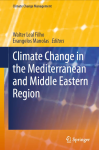
Ouvrage
W.L. Filho, ed. ; E. Manolas, ed. | Cham [Suisse] : Springer | Climate Change Management, ISSN 1610-2010 | 2022This book serves the purpose of showcasing some of the works in respect of applied research, field projects, and best practice to foster climate change adaptation across the region. Climate change is having a much greater impact in the Mediterr[...]
Article
Desertification is a serious threat to human survival and to ecosystems, especially to inland desert oases. An assessment of desertification severity is essential to ensure national sustainable development for agricultural and land expansion pro[...]
E-Book
H. Rey-Valette ; C. Jabbour ; P. Maurel ; J.-M. Salles | Versailles [France] : Editions Quae | Guide Pratique | 2022Les demandes et les usages des données spatiales satellitaires se développent et se diversifient de façon importante, en lien avec la précision, la fréquence des prises de vue et la taille des images. Ainsi, il convient de comprendre et de rendr[...]
Ouvrage
Mapping and Forecasting Land Use: The Present and Future of Planning is a comprehensive reference on the use of technologies to map land use, focusing on GIS and remote sensing applications and methodologies for land use monitoring. This book ad[...]
Article
Agricultural land abandonment is a relevant occurrence in mountainous and peripheral regions all over the world. While both positive and negative environmental consequences of this abandonment are documented (depending on the specific location a[...]
E-Book
Cet ouvrage expose les fondements théoriques indispensables à l’utilisation des systèmes d’information géographique (SIG) en présentant de manière simple les modèles vecteur et raster, les standards OGC, le SQL spatial ou les modèles numériques [...]
Article
A. Alitane ; A. Essahlaoui ; M. El Hafyani ; A. El Hmaidi ; A. El Ouali ; A. Kassou ; Y. El Yousfi ; A. Van Griensven ; C.J. Chawanda ; A. Van Rompaey |Soil erosion is an increasingly issue worldwide, due to several factors including climate variations and humans’ activities, especially in Mediterranean ecosystems. Therefore, the aim of this paper is: (i) to quantify and to predict soil erosion[...]
Article
Y.A. Sayed ; Y.A. Sayed ; M.E. Fadl |Agricultural sustainability development is essential in the modest Egyptian national income to improve land production and conservation of natural resources, which must cope with population growth with addition of new land reclamation that has l[...]
Article
Egypt suffers from severe water scarcity, which affects the sustainability of agricultural production. Therefore, the sustainable use of available water resources under water scarcity requires the adoption of water allocation policies favoring c[...]
Article
N. Zekri ; A. Tounkob |L’érosion hydrique est la principale forme de dégradation des sols en Algérie septentrionale. Ce phénomène naturel inévitable qui affecte notamment la partie nord-ouest du pays est exacerbé par les pratiques effarantes de l’homme et la fragilité[...]
Article
Agricultural expansion areas in the Egyptian deserts are one of the main governmental inputs that increased during the last decade. Evaluation of such agricultural lands helps decision makers in strategic planning of future projects. The present[...]
Article
Sweet chestnut is a relevant species in Europe for the production of timber and fruit, alongside environmental effects such as biodiversity of protection against soil erosion. In Portugal, chestnut is cultivated mainly for fruit production, in t[...]
Article
C.K. Kaymaz ; C. Cakir ; S. Birinci ; Y. Kizilkan |Ecotourism has become an integral part of the tourism sector for raising awareness of environmental protection, reducing the negative effects of tourism while using natural and cultural tourist attractions sustainably. The study primarily aims t[...]
Article
Determination of suitable locations for agricultural products is an important subject to study, as it is essential to identify optimal areas for crop productivity and sustainable farming activities. This study proposes a site selection assessmen[...]
Article
In 2018, Spain was the third largest producer and the leading exporter of wine in the world. Viticulture is an important economic activity in the Castilla y León region, and is an element capable of halting the flight from the countryside and fa[...]
Article
Participatory spatial tools-community mapping, PGIS, and others-find increasing resonance among research and non-governmental organizations to make stakeholder claims and community perspectives explicit for more inclusive landscape governance. I[...]
Article
C. Picone ; R. Henke ; M. Ruberto ; E. Calligaris ; R. Zucaro |The aim of this work is to evaluate the sustainability of water management for agriculture in a specific territory through the creation of a synthetic index resulting from the aggregation of multiple indices (environmental, economic, and social)[...]
Article
The Harran Basin is an important region where agricultural activities have been conducted for millennia. The agricultural water needs of the basin are largely met with surface irrigation through the GAP (South-Eastern Anatolian Project), while g[...]


