


Catégories
|
Thésaurus IAMM > RELEVE DES DONNEES > TELEDETECTION
TELEDETECTIONSynonyme(s)Détection à distance ;Image spot Image landsatVoir aussi |

Documents disponibles dans cette catégorie (194)
 Ajouter le résultat dans votre panier Affiner la recherche
Article
P. Jain ; D. Marcos ; D. Ienco ; R. Interdonato ; T. Berchoux |Vision–language models (VLMs) have shown significant promise in remote sensing applications, particularly for land-use and land-cover (LULC) mapping via zero-shot classification and retrieval. However, current approaches face several key challen[...]
Article
Context: Crop yield prediction (CYP) along with crop growth parameter estimation (CGPE) recently gained prominence as essential means for optimizing agricultural resource use and addressing global food security challenges, particularly in region[...]
Article
Article
G.R. Watmough ; D. Brockington ; C.L.J. Marcinko ; O. Hall ; R. Pritchard ; T. Berchoux ; L. Gibson ; E. Delamonica ; D. Boyd ; R. Mlambo ; S. O Héir ; S. Seth |The use of Earth Observation Data and Machine Learning models to generate gridded micro-level poverty maps has increased in recent years, with several highprofile publications. producing some compelling results. Poverty alleviation remains one o[...]
Article
C. Coman ; E. Coman ; V. Gherhes ; A. Bucs ; D. Rad |The growing demand for sustainable food production has driven significant advancements in modern agriculture, including increasing interest in Controlled Environment Agriculture (CEA), a high-tech solution designed to provide fresh, local, and o[...]
Article
In Mediterranean regions, climate change is leading to reduced precipitation, along with more frequent and severe droughts, and prolonged periods of water scarcity. In this context, as reservoir levels drop dramatically, some irrigated agricultu[...]
Article
Y. Ayadi ; M. Gentilucci ; K. Ncibi ; R. Hadji ; Y. Hamed |Groundwater in northwest Tunisia plays a vital role in supporting the domestic, agriculture, industry, and tourism sectors. However, climate change and over-exploitation have led to significant degradation in groundwater quality and quantity. Tr[...]
Article
Characterizing and quantifying crop diversity (“effective number of crops”) across scales is needed to understand a wide range of issues related to resilience of farms and the agricultural sector, the provision of ecosystem services, and ultimat[...]
Article
Article
The frequent occurrence of global climate change and natural disasters highlights the importance of precision agricultural monitoring, yield forecasting, and early warning systems. The data assimilation method provides a new possibility to solve[...]
Article
K.P. Devkota ; A. Bouasria ; M. Devkota ; V. Nangia |Wheat plays a crucial role in Morocco?s food security, economic stability, and livelihoods of farming communities. Assessing key vegetation indices (as yield predictors), along with understanding potential yield, yield gap, and major determinant[...]
Article
Farmers' preferences toward practice- and results-based agri-environmental schemes (AES) are analysed using a labelled choice experiment. The analysis focuses on schemes involving an innovative satellite-based monitoring system, with different e[...]
Article
S. Chiappini ; E. Marcheggiani ; A. Galli ; A. Khosravi ; M.D.A.M. Choudhury ; M. Balestra ; D. Neri |This research examines the evolution of olive landscapes in Cartoceto, Italy, post-World War II. This study investigates the structural and functional attributes of two distinct olive cultivation models, mixed olive groves with a low tree densit[...]
Article
The integration of remote sensing and socio-economic data is crucial for policy making in regions suffering from water scarcity and climate change. We present a framework that combines remotely sensed estimates of biomass and water use from FAO'[...]
Actes de Congrès ou Communication isolée
P. Jain ; D. Marcos ; D. Ienco ; R. Interdonato ; A. Dhakal ; N. Jacobs ; T. Berchoux | 2024A major difference between ground-level and satellite imagery of landscapes lies in their semantic granularity: ground-level images tend to offer details on objects and human activities, while satellite images provide broader geographic context [...]
Thèse, Mémoire, Master
C. Grimene | 2024La préservation des ressources naturelles à travers la gestion de la pollution diffuse liée à l’utilisation des produits phytosanitaires en agriculture est considérée ces dernières années et depuis le grenelle environnement lancé en 2007 comme u[...]
Article
Le suivi de la durabilité écologique des agroécosystèmes est nécessaire pour atténuer les impacts négatifs de l’agriculture sur l’environnement. Le développement de l’observation de la terre par satellite permet ce suivi sur de larges zones. Plu[...]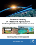
Ouvrage
S. Lamine ; P.K. Srivastava ; A. Kayad ; F. Muñoz-Arriola ; P.C. Pandey | Oxford [Royaume-Uni] : Academic Press | Earth Observation Series | 2024Remote Sensing in Precision Agriculture: Transforming Scientific Advancement into Innovation compiles the latest applications of remote sensing in agriculture using spaceborne, airborne and drones’ geospatial data. The book presents case studies[...]
Article
A. Karmaoui ; A. Moumane ; S. El Jaafari ; A. Menouni ; J. Al Karkouri ; M. Yacoubi ; L. Hajji |Remote sensing (RS) data and geographic information system (GIS) techniques were used to monitor the changes in the Oasis agroecosystem of the pre-Saharan province of Errachidia, southeastern Morocco. The land use and land cover (LULC) change of[...]
Article
K. Mainali ; M. Evans ; D. Saavedra ; E. Mills ; B. Madsen ; S. Minnemeyer |Landscape scale wetland conservation requires accurate, up-to-date wetland maps. The most useful approaches to creating such maps are automated, spatially generalizable, temporally repeatable, and can be applied at large spatial scales. However,[...]
Actes de Congrès ou Communication isolée
S. El Harche ; M. Chikhaoui ; N. Mustapha | 2023Land cover and soil maps are widely used in hydrological modeling studies, and serve as a critical foundation for many applications around the world. The Food and Agriculture Organization (FAO) and the European Space Agency and Climate Change In[...]
Article
R.S. Makar ; S.A. Shahin ; M. El-Nazer ; A. Wheida ; M. Abd El-Hady |Climate change and its impact on agriculture and water resources have become a global concern. The implications of extreme weather events on food production and water resource availability are starting to have social and economic effects worldwi[...]
Article
G. Cecili ; P. De Fioravante ; L. Congedo ; M. Marchetti ; M. Munafò |In recent years, deep learning (DL) algorithms have been widely integrated for remote sensing image classification, but fewer studies have applied it for land consumption (LC). LC is the main factor in land transformation dynamics and it is the [...]
Article
Drought is considered one of the key barriers influencing wheat production, and various adaptation schemes are practiced globally to mitigate drought impacts. However, it is difficult to precisely assess the performances of drought mitigation me[...]
Article
N.N. Kourgialas ; A. Hliaoutakis ; A.V. Argyriou ; G. Morianou ; A.E. Voulgarakis ; E. Kokinou ; I.N. Daliakopoulos ; D. Kalderis ; K. Tzerakis ; G. Psarras ; N. Papadopoulos ; T. Manios ; A. Vafidis ; P. Soupios |The aim of this paper is the creation of an integrated and free-access web platform for parcel irrigation water management on a large spatial scale (Water District of Crete, in Greece) in order to: a) accurately determine the irrigation needs of[...]
Article
We are currently living in the era of big data. The volume of collected or archived geospatial data for land use and land cover (LULC) mapping including remotely sensed satellite imagery and auxiliary geospatial datasets is increasing. Innovativ[...]
Article
Effective agricultural water management requires accurate and timely identification of crop water stress at the farm-scale for irrigation advisories or to allocate the optimal amount of water for irrigation. Various drought indices are being uti[...]
Article
R. Gamal ; M. El-Shirbeny ; A. Abou-Hadid ; A. Swelam ; A.-G. El-Gindy ; Y. Arafa ; V. Nangia |Evapotranspiration (ET) is a significant consumer of irrigation water and precipitation on cropland. Global and regional interest in the sustainable management of limited freshwater supplies to meet the rapidly increasing population and food dem[...]
Article
Salinization is a major soil degradation threat in irrigated lands worldwide. In Portugal, it affects several pockets of irrigated agricultural areas, but the spatial distribution and intensity of soil salinity are not well known. Unlike convent[...]
Article
F.Z. Echogdali ; S. Boutaleb ; A. Bendarma ; M.E. Saidi ; M. Aadraoui ; M. Abioui ; M. Ouchchen ; K. Abdelrahman ; M.S. Fnais ; K.S. Sajinkumar |Ensuring water availability for agriculture and drinking water supply in semi-arid mountainous regions requires control of factors influencing groundwater availability. In most cases, the population draws its water needs from the alluvial aquife[...]


