


Catégories
|
Thésaurus IAMM > RELEVE DES DONNEES > TELEDETECTION
TELEDETECTIONSynonyme(s)Détection à distance ;Image spot Image landsatVoir aussi |

Documents disponibles dans cette catégorie (177)
 trié(s) par Date édition décroissante (Année d'édition décroissant(e)) Ajouter le résultat dans votre panier Affiner la recherche
Ouvrage
Ce livre tente de fournir des informations sur la télédétection à partir de divers concepts de base de la télédétection, ainsi que sur des sujets avancés tels que les grandes données, l'intelligence artificielle et les réseaux neuronaux. Le livr[...]
Article
M. Fontanet ; M. Fontanet ; E. Scudiero ; T.H. Skaggs ; D. Fernàndez-Garcia ; F. Ferrer ; G. Rodrigo ; J. Bellvert |Irrigation scheduling decision-support tools can improve water use efficiency by matching irrigation recommendations to prevailing soil and crop conditions within a season. Yet, little research is available on how to support real-time precision [...]
Article
H. Bazzi ; N. Baghdadi ; I. Fayad ; F. Charron ; M. Zribi ; H. Belhouchette |Better management of water consumption and irrigation schedule in irrigated agriculture is essential in order to save water resources, especially at regional scales and under changing climatic conditions. In the context of water management, the [...]
Actes de Congrès ou Communication isolée
H. Bazzi ; N. Baghdadi ; D. Ienco ; M. Zribi ; H. Belhouchette | 2020The objective of this paper is to present an approach for mapping irrigated areas at plot scale using the Sentinel-1 radar time series. Over a study site located in Catalonia region of north Spain, a dense temporal series of S1 backscattering co[...]
Article
The agricultural landscape of Mediterranean islands has transformed radically over the last 60 years. The results differ, due to the interplay of macro, national, and local factors for each setting. In this study, some of these trajectories of c[...]
Article
La région de Enfidha au centre de la Tunisie marquée par sa diversité paysagère est sujette aux facteurs de changements d’états des milieux. A partir d'une interprétation des images Landsat de 2007 et 2017, la dynamique de l'occupation du sol a [...]
Article
H. Bazzi ; N. Baghdadi ; I. Fayad ; M. Zribi ; H. Belhouchette ; V. Demarez |In the context of monitoring and assessment of water consumption in the agricultural sector, the objective of this study is to build an operational approach capable of detecting irrigation events at plot scale in a near real-time scenario using [...]
Actes de Congrès ou Communication isolée
H. Bazzi ; N. Baghdadi ; D. Ienco ; M. Zribi ; H. Belhouchette | 2020Irrigation plays a significant role in agricultural production in order to meet the global food requirement under changing climatic conditions. To fulfill the high demand for food with an ever-increasing global population, better planning of irr[...]
Article
Most crop models were developed and tested in homogeneous field conditions. However, these crop models are increasingly applied beyond the field scale for larger regions. Inadequate representation of the spatial variability at a larger scale int[...]
Article
Irrigation water accounting (IWA) plays a key role in irrigation management in arid or semi-arid environments. Currently, water managers perform IWA through indirect or direct measurements such as statistical methods or flow meters. However, the[...]
Article
The use of satellites to monitor crops and support their management is gathering increasing attention. The improved temporal, spatial, and spectral resolution of the European Space Agency (ESA) launched Sentinel-2 A + B twin platform is paving t[...]
Article
T. Nasser ; G. Faour ; L. Touchart |La plaine intérieure de la Beqaa est considérée comme le grenier agricole du Liban. Dans cette région, la sécheresse représente un problème majeur dont les conséquences sont aggravées par une absence de gestion efficace des ressources en eaux et[...]
Article
Computer vision technologies have attracted significant interest in precision agriculture in recent years. At the core of robotics and artificial intelligence, computer vision enables various tasks from planting to harvesting in the crop product[...]
Article
Le Programme national de la forêt et du bois 2016-2026 affiche comme objectif d’augmenter les prélèvements de bois en France tout en assurant le renouvellement de la forêt. Les forêts de montagne qui représentent environ un quart de la surface f[...]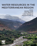
Ouvrage
M. Zribi, ed. ; L. Brocca, ed. ; Y. Tramblay, ed. ; F. Molle, ed. | Amsterdam [Pays-Bas] : Elsevier | 2020Water Resources in the Mediterranean Region summarizes and collates scientific developments around water resources in the Mediterranean socio-economic environment through a multidisciplinary framework synthesizing hydrology, hydrogeology, climat[...]
Article
E. Iwasaki ; S. Elbeih ; A. Shalaby ; H. Khedr ; E.S. Zaghloul |The number of deep groundwater wells in the arid lands of Egypt has increased greatly since the mid-twentieth century. Modern well drilling technology using rotary drilling rigs and pumping tests came to Egypt with the beginning of the New Valle[...]
Thèse, Mémoire, Master
La préservation des ressources naturelles à travers la gestion de la pollution diffuse liée à l’utilisation des produits phytosanitaires en agriculture est considérée comme un grand défi actuel en France. Les politiques de réduction de la pollut[...]
Article
P. Cathé ; B. Soenen ; M. Closset ; N. Benamou ; H. Poilvé ; M. Feuga |Service innovant unique au monde, Farmstar valorise les images satellites et des modèles agronomiques pour aider les agriculteurs dans leurs décisions d’apport d’azote en cours de campagne. Son succès, avec plus 16 000 agriculteurs abonnés explo[...]
Article
Les zones humides sont des milieux qui contribuent fortement au maintien de la biodiversité et de la qualité de l’eau. Elles se sont continuellement dégradées depuis une cinquantaine d’années, principalement sous l’effet de pressions anthropique[...]
Article
H. Bazzi ; N. Baghdadi ; M. El Hajj ; M. Zribi ; H. Belhouchette |This paper presents a comparison between the Sentinel-1/Sentinel-2-derived soil moisture product at plot scale (S 2 MP) and the new Copernicus surface soil moisture (C-SSM) product at 1-km scale over a wide region in southern France. In this stu[...]
Thèse, Mémoire, Master
A. Nasrallah | 2019With global production exceeding 750 million tons in 2017, wheat is considered a staple food for the world's population. Wheat mapping and monitoring could then be a very effective tool for achieving the Sustainable Development Goals (SDG2-Zero [...]
Article
H. Bazzi ; N. Baghdadi ; D. Ienco ; M. El Hajj ; M. Zribi ; H. Belhouchette ; M.J. Escorihuela ; V. Demarez |Mapping irrigated plots is essential for better water resource management. Today, the free and open access Sentinel-1 (S1) and Sentinel-2 (S2) data with high revisit time offers a powerful tool for irrigation mapping at plot scale. Up to date, f[...]
Article
H. Bazzi ; N. Baghdadi ; M. El Hajj ; M. Zribi ; D. Ho Tong Minh ; E. Ndikumana ; D. Courault ; H. Belhouchette |This study proposes an effective method to map rice crops using the Sentinel-1 SAR (Synthetic Aperture Radar) time series over the Camargue region, Southern France. First, the temporal behavior of the SAR backscattering coefficient over 832 plot[...]
Article
A. Nasrallah ; N. Baghdadi ; M. El Hajj ; T. Darwish ; H. Belhouchette ; G. Faour ; S. Darwich ; M. Mhawej |The ability of Synthetic Aperture Radar (SAR) Sentinel-1 data to detect the main wheat phenological phases was investigated in the Bekaa plain of Lebanon. Accordingly, the temporal variation of Sentinel-1 (S1) signal was analyzed as a function o[...]
Article
A. Ogilvie ; J. Riaux ; S. Massuel ; M. Mulligan ; G. Belaud ; P. Le Goulven ; R. Calvez |Millions of small reservoirs built across semi-arid areas present a potential to support agricultural livelihoods of rural smallholders. The scale and geographical dispersion of these multiple lakes restrict the understanding of these coupled hu[...]
Thèse, Mémoire, Master
Le Comité Champagne a adopté depuis plusieurs années le concept de viticulture de précison afin de mieux connaître et caractériser le vignoble à l’échelle de la parcelle. A partir de l’année dernière, le traitement des données de télédétection ([...]
Article
Numerous sensors have been developed over time for precision agriculture; though, only recently have these sensors been incorporated into the new realm of unmanned aircraft systems (UAS). This UAS technology has allowed for a more integrated and[...]
Bulletin : Revue
Revue des régions arides, n. 44 - Mars 2018 - Actes du colloque international "Développement socio-économique et dynamique des sociétés rurales : pluralité d'acteurs, gestion des ressources et développement territorial"
M. Jaouad, ed. ; M. Sghaier, ed. ; H. Khatteli, ed. | 2018
Thèse, Mémoire, Master
Le présent document s’intéresse à la détection et au suivi des cultures en Argentine. Ce pays fait partie des géants agricoles en terme de production en grandes cultures et en cultures oléagineuses telles que le soja et le blé. Dans ce contexte,[...]
Thèse, Mémoire, Master
Dans le domaine viticole, de nouveaux concepts permettant la gestion optimale des pratiques viticoles, ainsi que la caractérisation de la variabilité intra et inter parcellaire, tel que le concept de la viticulture de précision, se développent. [...]


